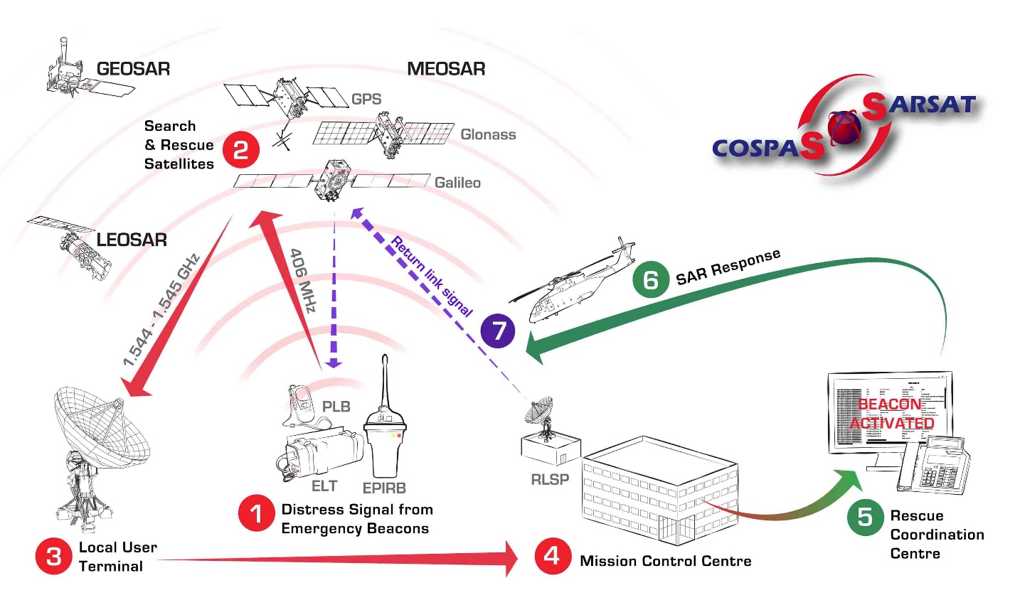
Search and Rescue (SAR) instruments are flown on board Low Earth Polar Orbiting (LEO), Medium Earth Orbiting (MEO) and Geostationary Earth Orbiting (GEO) satellites provided by the United States, Russian Federation, India, and the European Organization for the Exploitation of Meteorological Satellites (EUMETSAT). These satellites can detect signals coming from the Earth’s surface transmitted by 406 emergency distress beacons. These beacons operate on a 406MHz frequency and are battery powered radio transmitters designed solely to send a distress signal if activated. Once a beacon is activated it begins to transmit a continuous radio signal which is first picked up by the satellite instrumentation, then used by search and rescue to locate the emergency and render assistance.
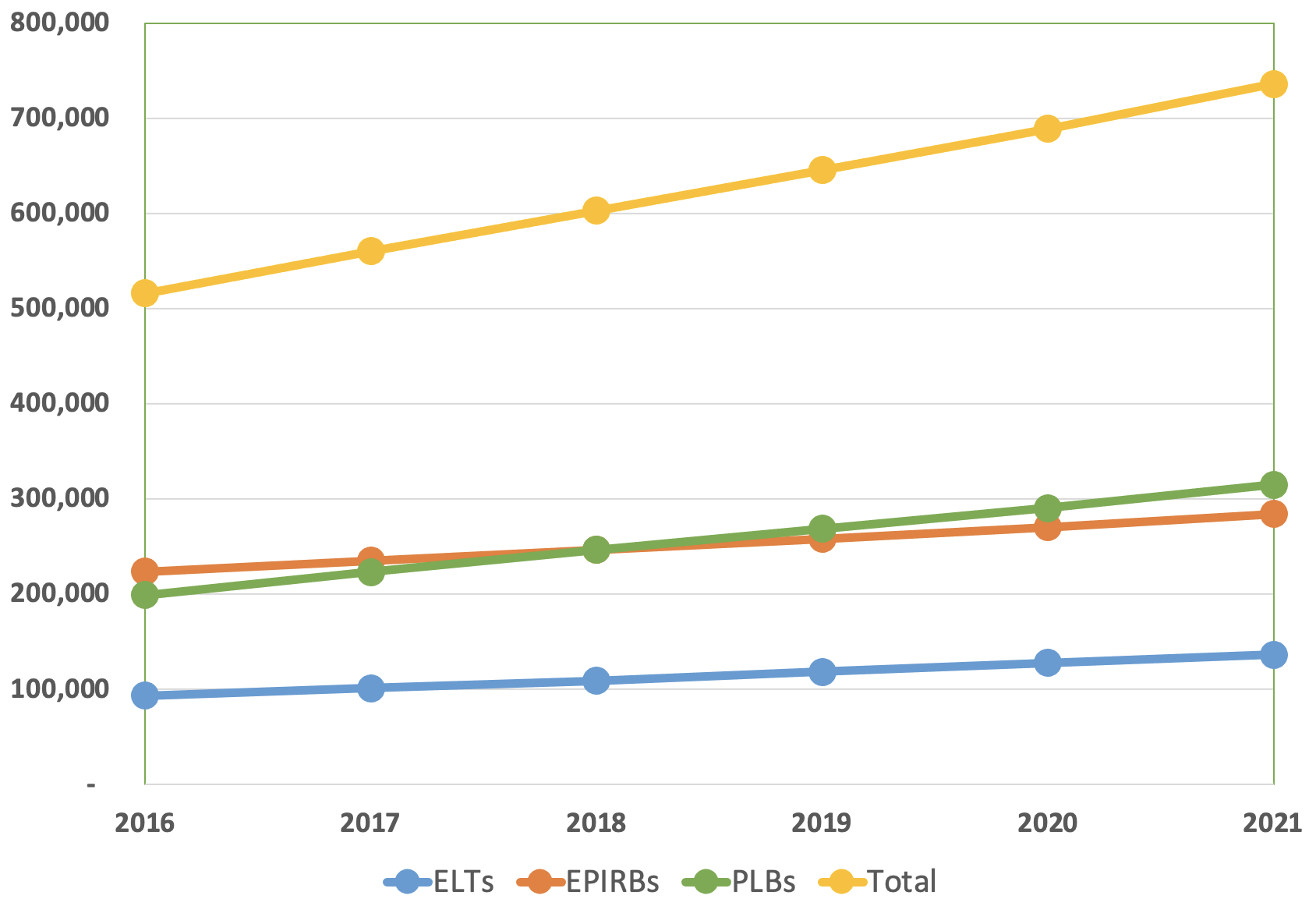
There are three types of 406MHz beacons, each with unique properties depending on the type of environment it is designed for: Emergency Locator Transmitters (ELTs) used by the aviation community, Emergency Position Indicating Radio Beacons (EPIRBs) used in the maritime environment, and Personal Locator Beacons (PLBs) used by individuals in multiple wilderness activities.
When activated, ELTs, EPIRBs, and PLBs transmit the distress signal on the 406 MHz frequency. This signal frequency has been designated internationally for use only for distress. Imbedded in this frequency is a unique digital code called a HEX ID. The HEX ID identifies the type of beacon and, if the beacon is registered, important information that helps search and rescue (SAR) specialists determine the best course of action.
This information can include: who the beacon owner is, the type of aircraft or vessel the beacon is associated with (for ELTs and EPIRBs), emergency points of contact, flight plans, float plans and wilderness trip plans, and much more. After the satellite receives a beacon signal, it relays the signal to ground stations referred to as local user terminals (LUTs). The LUT processes the data, computes the location of the distress beacon, and transmits a decoded alert message to its associated national Mission Control Center (MCC). This happens almost instantaneously after the initial beacon signal is received.
The MCC then automatically performs matching and merging of alert messages with other received messages, geographically sorts the data, and transmits a distress message to the closest appropriate SAR authority such as a national Rescue Coordination Center (RCC), a foreign SAR Point of Contact (SPOC) and another MCC if the beacon is for example registered to another country. The RCC investigates the beacon alert and launches rescue assets to find the parties in distress if the distress is deemed authentic. This can happen much quicker when the beacon is properly registered.
Return Link Service (RLS) is a new Cospas-Sarsat system enhancement which is coordinated by the French Space agency, CNES (Centre national d’études spatiales). This is an option built into the next generation 406 beacon itself.
In the case of the United States, the U.S. Mission Control Center (USMCC) receives distress signal data from its LUTs as well as other MCCs that have picked up the signal. It then transmits the distress message information to the closest U.S. national SAR services, such as the U.S. Air Force or U.S. Coast Guard RCCs, depending on the type of distress and its location.
The USMCC also transmits distress messages internationally to SPOCs located in other countries that might have assets in closer proximity to the distress, even though the distress situation is technically taking place within the USMCC service area.
Emergency beacons continue to show life-saving value
NOAA’s fleet of advanced satellites are essential for predicting weather and climate, and last year they also helped rescue 330 people from potentially life-threatening situations throughout the United States and its surrounding waters.
Of the 330 U.S. rescues, 195 were water rescues, 29 were from aviation incidents and 106 were from events on land. Alaska had the most SARSAT rescues with 55, followed by Florida with 52 and California with 37.
NOAA’s polar-orbiting and geostationary satellites are part of the global Search and Rescue Satellite Aided Tracking system, or COSPAS-SARSAT, which uses a network of U.S. and international spacecraft to detect and locate distress signals sent from emergency beacons from aircraft, boats and handheld Personal Locator Beacons (PLBs) anywhere in the world. Since its start in 1982, COSPAS-SARSAT has been credited with supporting more than 48,000 rescues worldwide, including more than 9,700 in the United States and its surrounding waters.
A graphic showing 3 categories of satellite-assisted rescues that took place in 2021: Of the 330 lives saved, 195 people were rescued at sea, 29 were rescued from aviation incidents and 106 were rescued from incidents on land.(NOAA)
When a NOAA satellite pinpoints the location of a distress signal in the U.S., the information is relayed to the SARSAT Mission Control Center at NOAA’s Satellite Operations Facility in Suitland, Maryland. From there, the information is sent quickly to Rescue Coordination Centers, operated either by the U.S. Air Force for land rescues, or the U.S. Coast Guard for water rescues. NOAA also supports rescues globally by relaying distress signal information to international SARSAT partners.
Among the success stories last year, a miner was rescued from a 20-foot shaft about 30 miles northwest of Phoenix, Arizona, in the Bradshaw Mountains. The Air Force Rescue Coordination Center received the alert from the PLB and contacted the owner, who provided the details of the distress. The Yavapai County Sheriff’s Office deployed a helicopter and emergency medical units to the scene. Rescuers pulled the miner from the shaft and transported him to a Phoenix hospital for treatment of multiple injuries.
“Each rescue shows the SARSAT system works as planned," said Steve Volz, Ph.D., assistant NOAA administrator for its Satellite and Information Service. "Its life-saving ability is built on four decades of teamwork with the U.S. Coast Guard, the U.S. Air Force, NASA and our international partners.”
By law, beacon owners are required to register their devices online with NOAA. The registration information helps provide better and faster assistance to people in distress, and reduces false alarms. It may also provide what type of help is needed.
")